Mapating Dive Site
Anilao (Batangas), Philippines · Near Anilao
Overview
Mapating sits off the western tip of Maricaban Island in Anilao's outer waters, a submerged pinnacle that earned its name from local fishermen who grew tired of losing their catch to sharks. "Mapating" translates roughly to "lots of sharks" in the local dialect, and while the name was given decades ago when whitetip reef sharks crowded the reef in numbers, the site still delivers the kind of raw, current-swept diving that most of Anilao's macro-focused visitors never experience.
The pinnacle rises from depth to a relatively shallow plateau at around 12 metres, then drops away in a series of walls and overhangs that plunge to 40 metres and beyond. On the deeper western face, a substantial cave system cuts into the rock, with the entrance sitting at roughly 42 metres. This is not a swimthrough. It is an overhead environment that extends well beyond ambient light, with passages branching at a Y-junction roughly 20 metres inside. Technical divers come here specifically for the cave. Recreational divers come for the pinnacle itself, which offers enough drama in the shallows and mid-depths to fill multiple dives without going anywhere near the overhead section.
Getting to Mapating takes commitment. The boat ride from most Anilao resorts runs 30 to 45 minutes around the far side of Maricaban Island, through open water where the surface can get rough. The site sits in exposed blue water with no land reference nearby, so your boat captain needs to know the exact spot. Not every operator runs trips here regularly, and conditions need to cooperate. When they do, you get a dive site that feels nothing like the rest of Anilao.
Where most Anilao sites reward slow crawling across sandy slopes looking for nudibranchs, Mapating rewards looking up, looking out, and paying attention to the blue water beyond the reef edge. This is a pelagic site first, a wall dive second, and a cave dive for those qualified. The current brings the action, and when it runs hard, the reef lights up with feeding fish in a way that the sheltered macro sites inside the Maricaban Passage simply cannot match.
The site does not see heavy traffic. Its distance from the main dive area, the strong currents, and the depth mean that most day-trip divers never make it here. Those who do tend to be experienced divers specifically requesting the site, or guests at resorts that maintain the logistics and local knowledge to run the trip safely. That relative solitude is part of the appeal.
Marine Life at Mapating
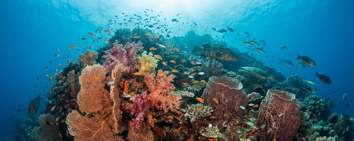
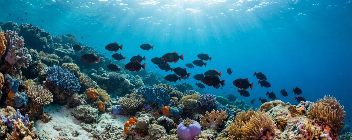
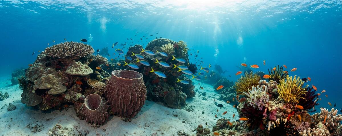
The shallow plateau between 12 and 18 metres is covered in healthy hard corals and scattered soft coral growth. It is not the most visually spectacular reef flat in the Philippines, but what it lacks in colour it compensates for with fish action. Anthias hover above the coral heads in shifting clouds, while damselfish stake out territories with predictable aggression. Sweetlips hang under ledges in small groups. Moorish idols cruise the reef edge in pairs.
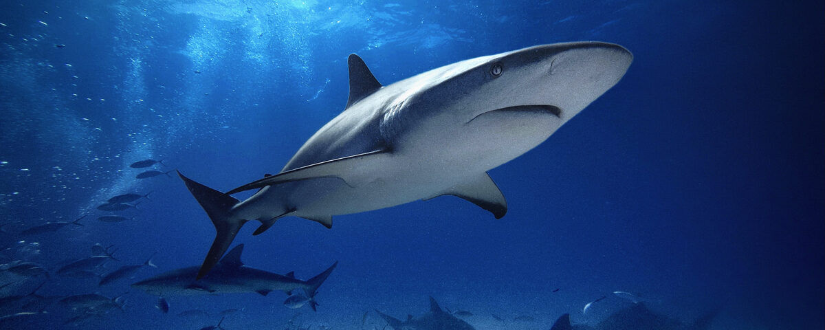
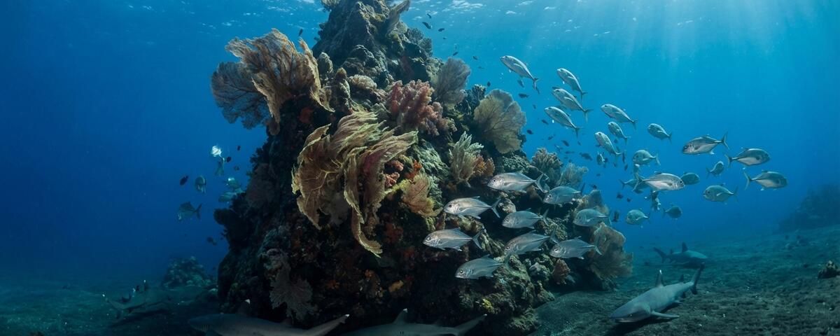
The walls below the plateau are where things escalate. Gorgonian fans grow from the rock face at 20 to 30 metres, some of them large enough to frame a diver for wide-angle photography. Black coral bushes cluster in the deeper sections. The wall is punctuated by overhangs and crevices that provide resting spots for whitetip reef sharks, though their numbers have declined significantly from the days that gave the site its name. You might see one or two sleeping under a ledge on a good day. Grey reef sharks patrol the deeper water column and are more reliably encountered, especially when the current is running.
Bigeye and bluefin trevally are the workhorses of this site. Schools move through on current, sometimes tight balls of fish spinning past the reef edge, sometimes loose formations drifting through the blue. Barracuda show up regularly, both great barracuda as solitary cruisers and chevron barracuda in small schools. Tuna pass through the deeper water when conditions align, though sightings are seasonal rather than guaranteed.
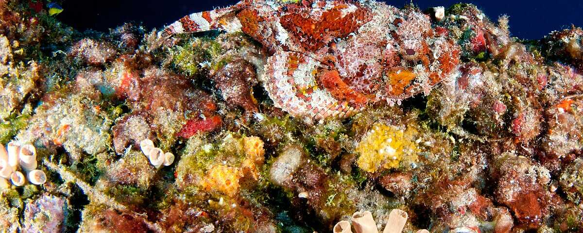
The cave entrance on the western face is guarded by a mermaid statue placed there by early technical diving explorers. Even if you have no intention of entering the cave, the entrance area at 42 metres is worth a look for qualified deep divers. Marble rays have been spotted resting near the entrance, and their egg cases sometimes hang from the rock around the opening. The area immediately outside the cave mouth attracts species that prefer low-light environments, including squirrelfish and soldierfish in small aggregations.
Inside the cave itself (for trained cave or cavern divers only), the main passage extends roughly 10 metres before splitting into two tunnels at a Y-junction. Each tunnel continues for another 20 metres. The cave walls support minimal life, but the experience of sitting at the end of a passage 50 metres inside a Philippine reef, lights off, watching bioluminescence spark with every movement, is one of the more unusual underwater experiences available in the country.
Macro life exists at Mapating but plays second fiddle to the big picture. Nudibranchs are scattered across the plateau, and you will find the usual Anilao suspects if you look for them. But spending an entire dive at Mapating hunting nudibranchs would be like visiting a steakhouse and ordering the salad.
Dive Conditions
Strong currents define this site. The exposed position off Maricaban Island's western tip means tidal flows hit the pinnacle directly, and there is little shelter. Current direction and intensity change with the tide cycle, and conditions can shift during a single dive. On slack tide, the site is manageable for competent intermediate divers. When the current runs, and it frequently runs hard, this becomes advanced territory.
Positive wall drift is the typical pattern. You drop in up-current of the pinnacle, descend quickly to the reef, and let the flow carry you along the wall. Negative entries into blue water are occasionally necessary depending on conditions, and your boat crew will advise on timing. Carrying a surface marker buoy is not optional here. If you miss the reef on descent or get swept off the wall, you will surface in open water and need to be spotted.
Visibility fluctuates between 8 and 25 metres depending on current, plankton density, and season. The best visibility tends to occur during the northeast monsoon season from November to May, with February to April being the sweet spot. Plankton blooms reduce visibility but attract more pelagic activity, so the trade-off works in your favour for big fish encounters even when the water is green.
Depth management requires attention. The plateau sits at 12 metres, which is comfortable, but the walls drop quickly and it is easy to drift deeper than intended while following the wall contours or chasing a shark sighting. The cave entrance at 42 metres and the passages beyond are well into technical diving territory. Recreational divers should establish a maximum depth before the dive and stick to it.
Water temperature ranges from 25 to 30 degrees Celsius through the year. The cooler temperatures occur during the northeast monsoon when thermoclines can create a noticeable temperature drop below 25 metres. A 3mm wetsuit works for most of the year; bring a 5mm if you are doing deeper profiles or multiple dives in the cooler months.
Surface conditions can be rough. The boat ride crosses open water, and swells from the South China Sea sometimes make the journey uncomfortable. Seasickness medication is worth considering if you are prone. Once on site, surface current and chop can make entries and exits athletic. Giant stride entries from bangkas are standard.
⚓ Divemaster Notes
Mapating is a site that sorts itself. The boat ride, the current, and the depth profile mean you rarely get someone here who should not be here. But I still brief it carefully because complacency at this site gets punished fast.
The standard profile I run starts with a negative entry into blue water if we cannot hook the reef directly from the surface. I want everyone grouped up at 5 metres before we descend to the plateau together. Splitting up on descent at a current-swept site in open water is how people get lost, and searches at Mapating waste air that nobody can spare.
Once on the plateau at 12 metres, I read the current direction and decide which way we drift along the wall. Southwesterly current pushes you along the main wall and past the cave entrance; northeasterly current takes you around the back of the pinnacle where the gorgonians are thickest. Both profiles work. I never fight the current here. You go where it takes you and build your dive plan around that.
For recreational groups, I keep things between 12 and 30 metres and focus on the wall section with the best gorgonian coverage. The whitetip resting spots are at 22 to 25 metres on the southwestern face. I know three reliable ledges where they tuck in, though "reliable" means about 60 percent of the time these days. I always manage expectations about shark encounters in the briefing. The name oversells the current reality.
I do not take recreational divers to the cave entrance. Full stop. The depth alone (42 metres) puts you into deco territory, and the overhead environment has killed people at other sites. If you want the cave, you book a technical dive with proper equipment, gas planning, and backup lights. I can arrange that with advance notice, but it is a different dive entirely.
One thing I always emphasise in the briefing: deploy your SMB at 5 metres, not at depth. The current at the surface and the current at depth can run in completely different directions here. If you deploy deep, your SMB line will angle dramatically and the boat may not be able to follow it. Deploy shallow, keep it tight, and surface close to where the boat expects you.
The best conditions I have seen here are on a neap tide during the morning, typically February or March. The current drops to something manageable, the viz opens up to 20 metres or better, and the reef fish activity on the plateau is exceptional. Those are the days I bring my camera.
How to Get to Mapating
Mapating lies off the western tip of Maricaban Island, roughly 30 to 45 minutes by motorised bangka from the main Anilao dive resort area in Barangay Ligaya and Barangay Solo, Mabini, Batangas.
Anilao itself is approximately 130 kilometres south of Manila, reachable in 2.5 to 3.5 hours by road depending on traffic. From Ninoy Aquino International Airport (NAIA), the most direct route follows the SLEX expressway south through Batangas province. Most dive resorts arrange private transfers for PHP 3,500 to 5,000 per vehicle each way. Public buses run from Manila to Batangas City, from where a tricycle or van covers the remaining 30 minutes to Anilao.
Once at your resort, Mapating requires a dedicated boat trip. Not all operators include it in their standard rotation because of the distance and the need for experienced boat captains who know the exact mooring position in open water. The site has no permanent mooring buoy. Your captain locates the submerged pinnacle by GPS and visual reference, which is why local knowledge matters enormously.
Best practice is to request Mapating specifically when booking or during your dive briefing the evening before. Some operators require a minimum number of divers to justify the fuel and time for the longer boat ride. Others include it as part of a multi-site trip that combines Mapating with Sepok Wall or Devil's Point, both of which sit along the same stretch of Maricaban Island's coastline.
Domestic flights from Cebu, Boracay, or other Philippine destinations connect through Manila. If arriving on an early morning flight, it is possible to reach Anilao by early afternoon and dive the same day, though most visitors prefer to arrive the day before and start diving fresh.
Gear Recommendations
A 3mm full wetsuit handles Mapating's water temperatures for most of the year. Switch to a 5mm if diving in the cooler months (December to February) or if your dive plan takes you below 25 metres where thermoclines can drop temperatures noticeably. Surface marker buoy is mandatory, not optional. Carry a whistle and mirror as surface signalling aids. If you get separated from the group and surface in open water, you need to be found. A reef hook can be useful on the plateau if you want to hold position against the current to watch passing pelagics, but it requires a solid attachment point and awareness of where your fins are relative to the coral. For photographers, wide-angle is the clear choice at this site. The gorgonians, the walls, the schooling fish, and the scale of the pinnacle all demand wide glass. Bring a video light or strobe powerful enough to illuminate gorgonians at 25 metres. Macro lenses are wasted here unless you are specifically spending the dive on the plateau hunting nudibranchs, which would be an unusual choice. Nitrox is strongly recommended for the wall diving. EAN32 extends your no-deco limits at 20 to 30 metres significantly, and at a site where current can extend your bottom time unexpectedly, that extra buffer matters.
Recommended Dive Operators
Planet Dive Anilao has been running trips to Mapating for years and their boat captains know the mooring position precisely. Their guides are comfortable managing groups in strong current and will adjust the dive plan on the fly based on conditions. Maximum group sizes of four divers per guide keep things manageable at a site where current awareness is critical. Solitude Acacia Resort on the Anilao waterfront runs Mapating when conditions allow, with experienced PADI instructors who brief thoroughly on current management and emergency procedures. They tend to schedule it as a first dive of the day when conditions are typically calmest. Dive Solana offers Mapating as part of their advanced dive programme, pairing it with other exposed sites around Maricaban Island for a full day of current diving. Their operation is geared toward experienced divers and they will not take beginners to this site. Aiyanar Beach and Dive Resort, located further along the Anilao coastline, includes Mapating in their site rotation and is a solid choice for photographers wanting extended bottom time at the reef's shallower sections.
Liveaboard Options
Mapating is overwhelmingly a land-based diving destination, accessed from the dozens of dive resorts lining the Anilao coastline. Liveaboards are not required and few schedule the site specifically.
That said, several Philippine liveaboard itineraries pass through Anilao waters as part of broader routes. The Solitude One and the Philippine Siren both operate routes that can include Anilao sites when departing from or returning to Batangas port. These vessels typically prioritise Tubbataha, Apo Reef, or the Visayas for their main itinerary, with Anilao serving as a warm-up or wind-down stop.
For most divers, a land-based stay of three to five days in Anilao is the practical approach. Dive packages at Anilao resorts range from PHP 2,000 to 4,000 per dive (roughly USD 35 to 70) with discounts for multi-day bookings. The Mapating trip may carry a fuel surcharge due to the longer boat ride, typically PHP 500 to 1,000 per diver. Accommodation ranges from budget guesthouses at PHP 1,500 per night to comfortable dive resorts at PHP 4,000 to 8,000 per night, most with direct waterfront access and on-site dive centres.